The Water Cycle and the Role of Snow in the Western United States
by Kendra Young
Everyone should remember that day in elementary school when they had to draw the water cycle – the bright yellow sun with sunglasses shining over the blue water, the arrow showing the cloud moving over the landscape, the raindrop dots falling on the mountains, followed by the river flowing back into the ocean, to start the cycle over again. The perfect illustration of the water cycle. As students advanced in their academic careers, the water cycle grew more advanced as well. Words like infiltration, percolation, sublimation, and transpiration joined the common turns of evaporation, condensation, transportation, and precipitation as the water cycle’s complexity grew. Illustrations grew more robust and included more arrows and more example images. All to say, the water cycle is a complex system that is a part of everyone’s life, and agriculturalists know this better than anyone.
A scientific diagram, especially of the water cycle, is a grand thing – it proves a point or concept and illustrates the inner workings of a system, but what does it actually mean for the layman, the on-the-ground farmer? Simply put, a disruption in one part of the diagram can spell disaster for a rancher. Too many raindrop dots falling as precipitation? Flood. The transportation arrow is too short or too long? Localized weather patterns affecting your neighbor. The sun in his glorious sunglasses is over-shining the landscape? Drought. Any sort of “hiccup” in the cycle can and will affect the surrounding ecosystem and the land managers that live there.
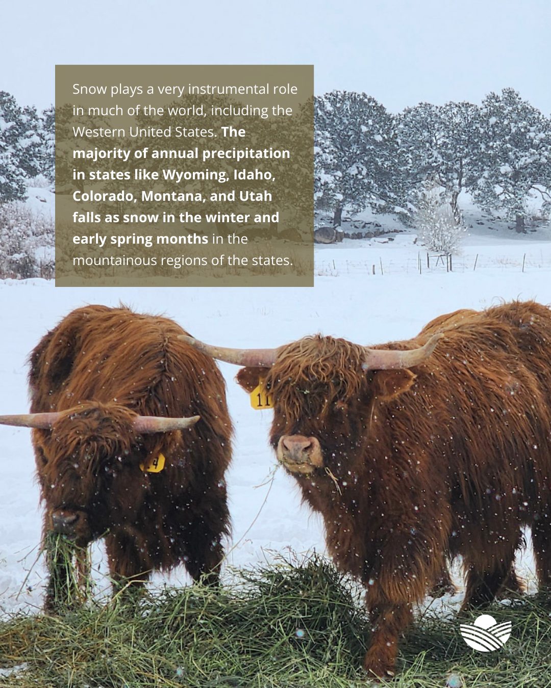
While a stereotypical drawing of the water cycle depicts a rainstorm, snow plays a very instrumental role in much of the world, including the western United States. The majority of annual precipitation in states like Wyoming, Idaho, Colorado, Montana, and Utah falls as snow in the winter and early spring months in the mountainous regions of the states. As the snow melts and becomes liquid water, it is stored in above-ground reservoirs or recharges the ground water system for usage throughout the rest of the entire year. Snow drifts can also persist late into the summer in higher elevation areas that remain colder longer, meaning water can also be stored as actual snow, and used only as it melts in the really warm months in the summer and fall of the year. This water can be used in a variety of ways -including municipally, agriculturally, or as irrigation depending on the water system, the need, and the region.
For many in the Intermountain West, the majority of their working water comes from melted snow. Examples of this water’s agricultural usages include: naturally filling stock ponds in large grazing areas for livestock consumption, crop irrigation water, and providing water for native forages to grow in non-cropped grazing systems. A lower winter snowpack usually means a rancher would need to haul water for livestock consumption and large grazing allotments could have no or stunted plant growth.
Agriculturalists, specifically farmers and ranchers, are very vigilant regarding their local weather and annual snowpack resources. They have to be, water is their livelihood or at least dictates the majority of it. Historically, an area’s snowpack was measured and the year’s activities planned on a more anecdotal system; including knowledge and stories passed down from generation to generation. Understanding the landscape and local topography was key in these systems. Familial and local stories like these could include things such as visually noting that when (if) the snow reached a certain landmark on the distant mountains, it would be an average water year or if the visible snow failed to reach that area, a less-than-normal water year or drought could be a potential. Or even not planting certain crops until the snow line receded to a certain landmark. The amount of snow and the visibility of snow was and is vital to operational management and planning, even now.
However, advances in scientific instruments, monitoring systems, and remote sensing opportunities have increased the amount of data and accuracy of this information in the monitoring and recording of snowpack and moisture content information; and also creating easily accessible avenues to share this information with the public. The United States Department of Agriculture’s Natural Resources Conservation Service(USDA NRCS) Snow Survey and Water Supply Forecasting Program is one such program. Among other resources and uses, the program manages remotely-operated snow-sites in remote regions or sends trained staff and equipment to pre-determined monitoring points to take snow depth and other pertinent measurements. This data is then compiled to create water forecasts and drought maps available to everyone.
Snow is important for livestock operations and everyone west wide. A low snow year or several low snow years in a row can be anywhere from detrimental to disastrous for agricultural operations, while a good snow year ensures plenty of water and green grasses. In conclusion, snow is a many-splendored thing. Local snowfall can be seen as a nuisance or something that create unsafe driving conditions, or it can be a fun winter pastime for families to enjoy together, but that snow has far-reaching effects. For those that rely on groundwater or reservoirs for their annual usage, and even natural precipitation on native forages, snow is crucial to their success.
Don’t miss our upcoming webinar on Snowpack & Effects on Drought Management, click to register!
Join NatGLC for an interactive Q&A-style webinar on March 18th at 1:00 PM (CT), hosted by Kendra Young, NatGLC Western Region Resource Manager, featuring Brian Domonkos, Colorado Snow Survey Supervisor. Together, they will explore available snow survey products and forecasting resources, discuss how to interpret the data, and answer participant questions focused on practical use for agricultural producers.